

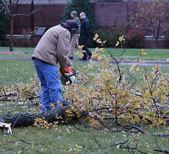
The storm system that many have called the “Hurricane of the Midwest” hit campus Tuesday evening.
Stray branches and knocked-over benches could be seen around campus. Assistant Physical Plant Director Jim Hoffman said the campus was not affected more than usual during a storm.
“We have the typical amount of roof leaks,” Hoffman said. “Although it is extremely windy.”
Senior Alycia Michels, commuter center adviser, said she thinks it will be tougher to get around as the snow continues throughout the day.
“It might be an interesting day because people are just starting to get used to bad weather again,” she said. “So obviously I think that people will start having issues, especially with traffic, and I know around campus can be a hassle too.”
Local problems
Thousands of Minnesotans remain without power and many travelers are stranded as high winds buffet Minnesota.
For a second straight day, Minneapolis-St. Paul International Airport is down to one operating runway Tuesday. Airport spokesman Pat Hogan said more than 100 flight cancellations Monday forced many travelers to spend the night at the airport or in nearby hotels.
Hogan said the airlines are trying to ensure against a huge backlog of people stuck in the terminal. He advises travelers to call their airlines for updates.
Xcel Energy said more than 28,000 Twin Cities area customers were without power as of 9 a.m.
The storm brought some of the first snow to Minnesota early Wednesday, and winter storm warnings are out for parts of northern Minnesota. The National Weather Service said westerly winds of 30 to 40 mph with gusts from 50 to 60 mph will persist over the region through the day.
The Duluth News Tribune reports that all Duluth public, parochial, charter and private schools and latchkey programs are closed. The National Weather Service is reporting over seven inches of snow in Duluth since Tuesday evening.
Record weather
The storm packed wind gusts of up to 81 mph Tuesday as it howled across the Midwest and South, snapping trees and power lines, ripping off roofs and delaying flights. The storm continued its trek early Wednesday, with snow falling in the Dakotas and Minnesota. More strong winds were in the forecast in several other states.
The National Oceanic and Atmospheric Administration said the system’s pressure reading Tuesday was among the lowest ever in a non-tropical storm in the mainland U.S. Spokeswoman Susan Buchanan said the storm was within the top five in terms of low pressure, which brings greater winds.
The fast-moving storm blew in from the Pacific Northwest on the strength of a jet stream that is about one-third stronger than normal for this time of year, said David Imy, operations chief at the NOAA’s Storm Prediction Center in Norman, Okla. As the system moved into the nation’s heartland, it drew in warm air needed to fuel thunderstorms. Then the winds intensified and tornadoes formed.
Gina Dolski can be reached at grdolski@stthomas.edu.